We Help Roofers Make More Money
Drones fly themselves and Artificial Intelligence is much more accessible as it sounds. You will be successful. We will make sure of it.
We believe that there should be a drone in every truck and used on every project
Challenges in Roofing Data Collection
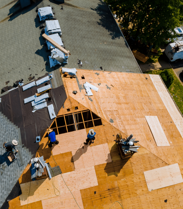
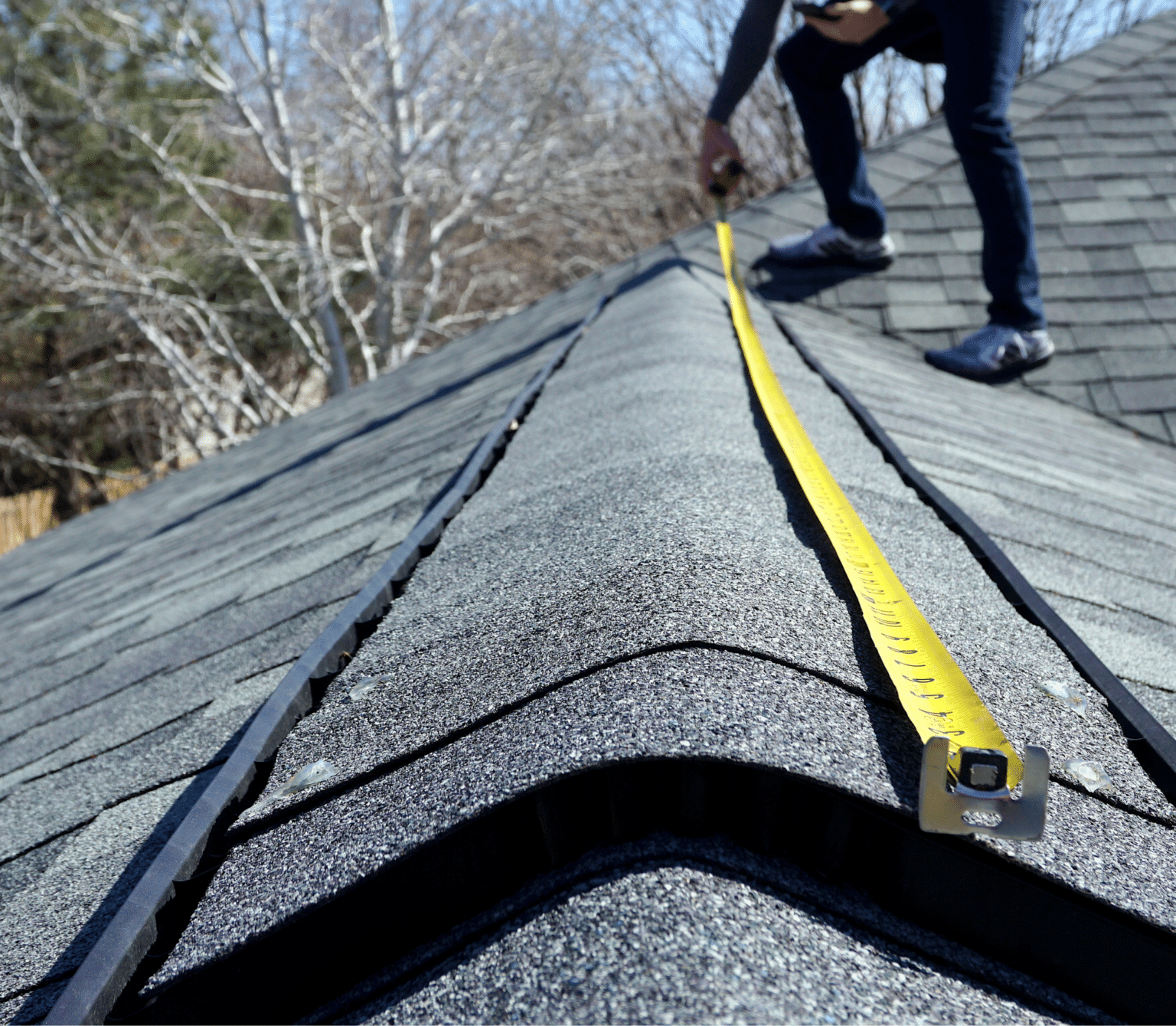
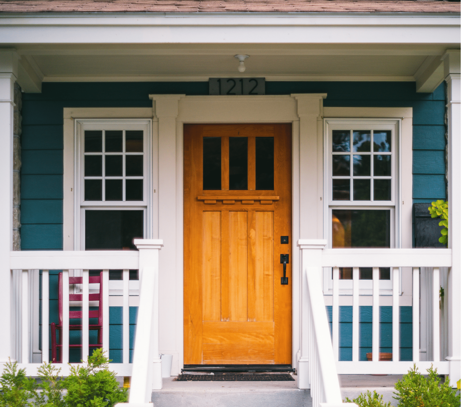
Roofing professionals often encounter significant challenges in collecting accurate and timely data for projects. Traditional methods, such as manual roof measurements and visual inspections, not only require considerable time and effort but also pose safety risks to staff. The need for precise, efficient, and risk-free data collection methods is more critical than ever to stay competitive and meet client demands effectively.
Agitation of the Problem
Imagine the constraints of relying solely on manual measurements—time-consuming climbs, potential for human error, and delays in project estimation and claims processing. Moreover, in the aftermath of a storm, the ability to quickly identify and assess damage is vital, yet traditional methods fall short, leading to slower response times and potential loss of business. These inefficiencies can bottleneck operations, impact service quality, and ultimately, profitability.
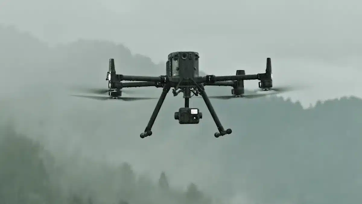
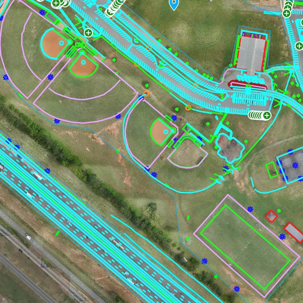
Revolutionizing Accuracy with Aerial LiDAR Mapping
Blue Falcon Aerial transforms roofing data collection with our drone and AI-driven solutions, harnessing our expertise as drone instructors at a major technology institute and our veteran-owned business heritage. Our services streamline your operations: from custom drone purchasing and tailored training programs to advanced data analysis with AI. We enable quick assessments of storm damage and systematic neighborhood scans for potential jobs. Enhance your project planning and estimations with precise measurements and autonomous drone flights, boosting accuracy and efficiency. With Blue Falcon Aerial, integrate cutting-edge technologies to not only meet current needs but also future-proof your business.
Benefits You Will See
Comprehensive Training and Support
We equip clients with the skills to safely and efficiently use drone technology through detailed training and customized flight procedures, streamlining the adoption process and reducing operational risks.
Streamlined Data Collection and Analysis
Our use of high-definition drone imagery and AI analysis enables rapid and accurate assessments of roof conditions. This technology facilitates quick responses to damage and streamlines the planning process.
Enhanced Project Management
We offer tools and services that improve project oversight and execution. From project estimation to comprehensive data processing support, we help businesses manage their projects effectively from start to finish.
Regulatory Compliance and Risk Management
Our consultation includes assistance with drone waivers and access to a network of professional pilots, ensuring compliance with aviation regulations and reducing legal risks for roofing businesses.
What Makes Us Different?
Not Your Regular Drone Guys
We are Drone Instructors at the prestigious Francis Tuttle Institute of Technology in Oklahoma City. You can trust that we know what we are doing and are qualified to help.
We have Access to the Best Tech
We seek out and partner with the best software, providers and drones for your business. We give you all of the options and let you make the decision.
Customized and Flexible to what you Need
One size does NOT fit all. We need to learn more about your pains and challenges so we can be creative in finding solutions that match your needs.
Veteran Owned and Operated
27 years of military experience between the founding members. Veterans are Disciplined, Hard Working and Adaptable to any Situation.
Yeah. We can do that.
Drone Selection
We can help you decide what drones make sense for your operations and budget. We also work with distributors to get you the best deals
Customized Playbook
We create your own step-by-step guide that you can follow to be successful.
Software Integration
We don't create our own software but we have done the shopping for you to make sure you have the ones you need.
Insurance Assurance
We work with insurance providers to make sure you are covered against liability and hull damage.
Drone Training
We have different options so you can learn how to fly. From YouTube links to In Person Training, its all up to you.
FAA Waivers and Authorizations
We can work with the Federal Aviation Administration to make sure you can fly where you need to fly.
Consultant to Bounce Ideas
Want to have us as a consultant so we can help as needed as things come up? We have a very qualified team to help in many different areas.
Project Management
Maybe you want us to take away some stress and manage the projects for you.
Data Processing
We can take data that you generate with your drones and turn it into whatever you need. Models, Maps, Assessments, Video Editing, or whatever else you probably need... We have a guy.
Marketing Plan
We love marketing and think we are pretty good at it. The fact you are here should be a good indicator of that.
Data Capture
We have access to pilots all over the country. Pilots are not cheap, and we firmly believe you should just fly yourselves, but we can help you if you would rather just outsource.
Other Stuff Too (Probably)
We pride ourselves on being a one stop shop for whatever you need. Everything's got a price of course.
Frequently Asked Questions
Here, you'll find detailed answers to common questions about our aerial LiDAR services, drone technology, and how we can support your unique project needs. This is your go-to resource for understanding our advanced drone-enabled LiDAR solutions.
For setting ground control, we are flexible to accommodate your needs. We can establish our own base station point, utilize a point already established by your surveyor, or tie into the same monument that the surveyor is using for the project. Using a rover connected to our base, we set ground points to ensure accurate geo-referencing of our LiDAR data.
Our aerial LiDAR technology can fly regardless of foliage coverage. While thick foliage can sometimes limit the visibility of the ground surface, we employ sophisticated processing techniques to optimize ground surface detection.
Absolutely. Our aerial LiDAR services are well-suited for highway projects. Our technology allows us to collect data quickly and accurately, significantly reducing the risk associated with traditional on-the-ground surveying.
No, we do not charge mileage. We proudly service all locations within the Continental United States without any additional travel fees.
We’re equipped to handle projects of any size. While there’s no limit to how small a project can be, please note that our minimum billing for any project is $2500.
Yes, our deliverables are fully compatible with CAD and other popular design software. We aim to provide data in a format that fits seamlessly into your workflow.
Getting started with us is easy. Simply reach out to us with your project details. We’ll discuss your requirements, offer a customized solution, and upon agreement, schedule the data collection process.
Turnaround time can vary based on the project’s complexity and size. However, we strive for efficiency, and most projects are completed within a few days to a week after the data collection process.
We deliver data securely through an online cloud platform, allowing you to access and download your data files conveniently. If required, alternative delivery methods can be arranged.
We strictly comply with all FAA regulations, including the limitation that prohibits flying over people or moving vehicles. We’ll discuss any potential restrictions and plan the project accordingly to ensure complete regulatory compliance.
Operations in restricted airspace, such as near airports, require specific permissions and waivers. Securing these can take a significant amount of time, up to 90 days. We work diligently to obtain these permissions in a timely manner to not delay your project.
No, our LiDAR technology is used for surface mapping and cannot penetrate the ground. We provide detailed and accurate surface mapping for your projects.